 vesseltracker.com
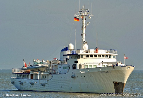
Vessel Capella C IMO: 1001130, MMSI: 232111000 Yacht
UTC, -1.24167, 129.50500, course: -1, speed: 7
UTC, -1.15833, 129.44833, course: -1, speed: 0
2026-01-18 21:52:01 UTC, -1.15833, 129.44833, course: -1, speed: 0
Live AIS position:
UTC. 66 nm S of Gebe Island),
updated 2026-01-18 21:52:01 UTC.
Find the position of the vessel Capella C on the map. The latter are known coordinates and path.
marine traffic ship tracker show on live map
The current position of vessel Capella C is -1.15833 lat / 129.44833 lng. Updated: 2026-01-18 21:52:01 UTCCurrently sailing under the flag of United Kingdom
Capella C built in 1968 year
Details:
Last coordinates of the vessel:
UTC, -1.40667, 129.52499, course: -1, speed: 8UTC, -1.24167, 129.50500, course: -1, speed: 7
UTC, -1.15833, 129.44833, course: -1, speed: 0
2026-01-18 21:52:01 UTC, -1.15833, 129.44833, course: -1, speed: 0