 vesseltracker.com
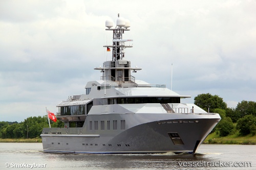
Vessel M.y.skat IMO: 1007287, MMSI: 319741000 Service Ship
UTC, 18.02820, -63.10168, course: 159, speed: 0
UTC, 17.99013, -63.13218, course: 219, speed: 8.2
2026-02-14 19:23:39 UTC, 17.89852, -63.22587, course: 271, speed: 8.4
Live AIS position:
UTC. Near Santa Cruz de la Sierra),
updated 2026-02-14 19:23:39 UTC.
Find the position of the vessel M.y.skat on the map. The latter are known coordinates and path.
marine traffic ship tracker show on live map
The current position of vessel M.y.skat is 17.89852 lat / -63.22587 lng. Updated: 2026-02-14 19:23:39 UTCDetails:
Last coordinates of the vessel:
UTC, 18.02810, -63.10177, course: 152, speed: 0.2UTC, 18.02820, -63.10168, course: 159, speed: 0
UTC, 17.99013, -63.13218, course: 219, speed: 8.2
2026-02-14 19:23:39 UTC, 17.89852, -63.22587, course: 271, speed: 8.4