 vesseltracker.com
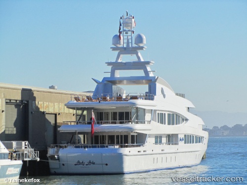
Vessel Lucky Lady IMO: 1007328, MMSI: 319713000 Service Ship
UTC, 24.62667, -79.62333, course: -1, speed: 12
UTC, 25.07500, -79.79333, course: -1, speed: 13
2026-02-28 08:21:51 UTC, 25.54500, -79.80833, course: -1, speed: 15
Live AIS position:
UTC. 22 nm SE of Fisher Island, Miami),
updated 2026-02-28 08:21:51 UTC.
Find the position of the vessel Lucky Lady on the map. The latter are known coordinates and path.
marine traffic ship tracker show on live map
The current position of vessel Lucky Lady is 25.54500 lat / -79.80833 lng. Updated: 2026-02-28 08:21:51 UTCCurrently sailing under the flag of Cayman Is
Lucky Lady built in 2002 year
Details:
Last coordinates of the vessel:
UTC, 24.16333, -79.32167, course: -1, speed: 12UTC, 24.62667, -79.62333, course: -1, speed: 12
UTC, 25.07500, -79.79333, course: -1, speed: 13
2026-02-28 08:21:51 UTC, 25.54500, -79.80833, course: -1, speed: 15