 vesseltracker.com
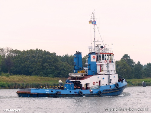
Vessel More IMO: 1007574, MMSI: 235005660 Service Ship
UTC, -13.40104, -107.38191, course: 65, speed: 10
UTC, -13.40104, -107.38191, course: 65, speed: 10
2026-02-22 08:46:03 UTC, -13.40104, -107.38191, course: 65, speed: 10
Live AIS position:
UTC. Open sea (no nearby ports in database)),
updated 2026-02-22 08:46:03 UTC.
Find the position of the vessel More on the map. The latter are known coordinates and path.
marine traffic ship tracker show on live map
The current position of vessel More is -13.40104 lat / -107.38191 lng. Updated: 2026-02-22 08:46:03 UTCCurrently sailing under the flag of United Kingdom
More built in 2003 year
Deadweight:
90 tDetails:
Last coordinates of the vessel:
UTC, -34.12427, -165.18765, course: 80, speed: 5.6UTC, -13.40104, -107.38191, course: 65, speed: 10
UTC, -13.40104, -107.38191, course: 65, speed: 10
2026-02-22 08:46:03 UTC, -13.40104, -107.38191, course: 65, speed: 10