 vesseltracker.com
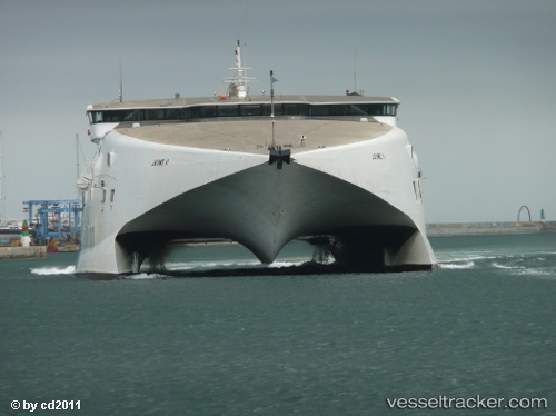
Vessel Jaume Ii IMO: 9116113, MMSI: 209513000 Passenger Ro Ro Cargo Ship
UTC, 25.75023, -79.28655, course: 310, speed: 0
UTC, 25.75020, -79.28655, course: 309, speed: 0
2026-03-01 21:36:23 UTC, 25.75020, -79.28655, course: 310, speed: 0
Live AIS position:
UTC. 45 nm E of Surfside),
updated 2026-03-01 21:36:23 UTC.
Find the position of the vessel Jaume Ii on the map. The latter are known coordinates and path.
marine traffic ship tracker show on live map
The current position of vessel Jaume Ii is 25.75020 lat / -79.28655 lng. Updated: 2026-03-01 21:36:23 UTCCurrently sailing under the flag of Cyprus
Jaume Ii built in 1996 year
Deadweight:
310 tDetails:
Last coordinates of the vessel:
UTC, 25.75019, -79.28654, course: 309, speed: 0UTC, 25.75023, -79.28655, course: 310, speed: 0
UTC, 25.75020, -79.28655, course: 309, speed: 0
2026-03-01 21:36:23 UTC, 25.75020, -79.28655, course: 310, speed: 0