 vesseltracker.com
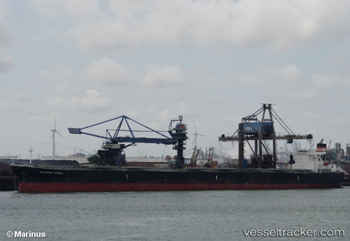
Vessel CAPE MARY M IMO: 9290880, MMSI: 210257000 Bulk Carrier
UTC, 38.86733, 119.15017, course: 48, speed: 0.1
UTC, 38.86728, 119.15018, course: -1, speed: 0.3
2026-02-27 01:48:18 UTC, 38.86652, 119.15397, course: 342, speed: 0.2
Live AIS position:
UTC. 21 nm S of JINGTANG),
updated 2026-02-27 01:48:18 UTC.
Find the position of the vessel CAPE MARY M on the map. The latter are known coordinates and path.
marine traffic ship tracker show on live map
The current position of vessel CAPE MARY M is 38.86652 lat / 119.15397 lng. Updated: 2026-02-27 01:48:18 UTCCurrently sailing under the flag of Cyprus
CAPE MARY M built in 2004 year
Deadweight:
177325 tDetails:
Last coordinates of the vessel:
UTC, 38.86742, 119.15007, course: -1, speed: 0UTC, 38.86733, 119.15017, course: 48, speed: 0.1
UTC, 38.86728, 119.15018, course: -1, speed: 0.3
2026-02-27 01:48:18 UTC, 38.86652, 119.15397, course: 342, speed: 0.2