 vesseltracker.com
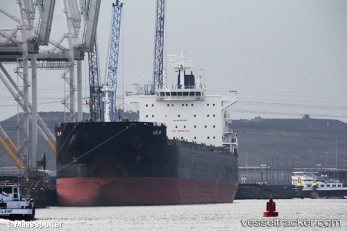
Vessel Lia M IMO: 9525625, MMSI: 210363000 Bulk Carrier
UTC, 21.33468, 113.48126, course: 213, speed: 12.6
UTC, 21.14455, 113.35636, course: 202, speed: 12.4
2026-02-04 19:36:18 UTC, 20.78072, 113.15475, course: 206, speed: 12.4
Live AIS position:
UTC. 53 nm SE of Shadi),
updated 2026-02-04 19:36:18 UTC.
Find the position of the vessel Lia M on the map. The latter are known coordinates and path.
marine traffic ship tracker show on live map
The current position of vessel Lia M is 20.78072 lat / 113.15475 lng. Updated: 2026-02-04 19:36:18 UTCDetails:
Last coordinates of the vessel:
UTC, 21.80142, 113.82110, course: 205, speed: 12.5UTC, 21.33468, 113.48126, course: 213, speed: 12.6
UTC, 21.14455, 113.35636, course: 202, speed: 12.4
2026-02-04 19:36:18 UTC, 20.78072, 113.15475, course: 206, speed: 12.4