 vesseltracker.com
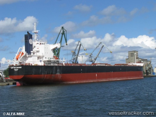
Vessel CAPTAIN GEORGE IMO: 9510357, MMSI: 210828000 Cargo
UTC, -19.11540, 150.64941, course: 197, speed: 11.6
UTC, -19.40933, 150.54536, course: 191, speed: 11.5
2026-02-25 19:58:19 UTC, -19.83868, 150.33720, course: 213, speed: 12
Live AIS position:
UTC. 55 nm SW of Coral Sea),
updated 2026-02-25 19:58:19 UTC.
Find the position of the vessel CAPTAIN GEORGE on the map. The latter are known coordinates and path.
marine traffic ship tracker show on live map
The current position of vessel CAPTAIN GEORGE is -19.83868 lat / 150.33720 lng. Updated: 2026-02-25 19:58:19 UTCDetails:
Last coordinates of the vessel:
UTC, -18.79167, 150.75667, course: -1, speed: 11UTC, -19.11540, 150.64941, course: 197, speed: 11.6
UTC, -19.40933, 150.54536, course: 191, speed: 11.5
2026-02-25 19:58:19 UTC, -19.83868, 150.33720, course: 213, speed: 12