 vesseltracker.com
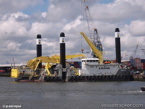
Vessel Magnor IMO: 9787601, MMSI: 212621000 Dredger
UTC, 51.46076, 3.69633, course: -1, speed: 0.3
UTC, 51.46067, 3.69624, course: -1, speed: 0.1
2026-02-07 16:09:29 UTC, 51.46076, 3.69633, course: -1, speed: 0.2
Live AIS position:
UTC. Near Nieuwdorp),
updated 2026-02-07 16:09:29 UTC.
Find the position of the vessel Magnor on the map. The latter are known coordinates and path.
marine traffic ship tracker show on live map
The current position of vessel Magnor is 51.46076 lat / 3.69633 lng. Updated: 2026-02-07 16:09:29 UTCDetails:
Last coordinates of the vessel:
UTC, 51.46074, 3.69612, course: -1, speed: 0.1UTC, 51.46076, 3.69633, course: -1, speed: 0.3
UTC, 51.46067, 3.69624, course: -1, speed: 0.1
2026-02-07 16:09:29 UTC, 51.46076, 3.69633, course: -1, speed: 0.2