 vesseltracker.com
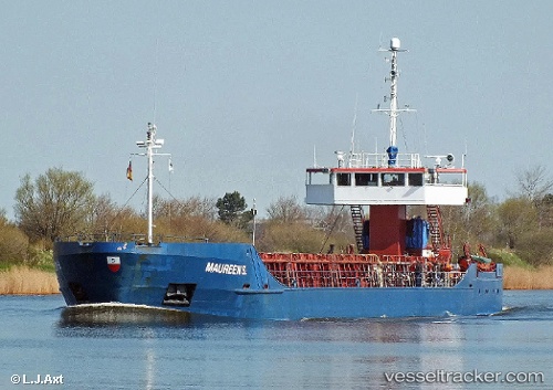
Vessel Maureen S IMO: 8509820, MMSI: 212746000 Multi Purpose Carrier
UTC, 9.12364, -79.80246, course: 315, speed: 8
UTC, 9.20747, -79.93354, course: 349, speed: 0
2026-02-06 16:10:35 UTC, 9.20772, -79.93302, course: 340, speed: 0.1
Live AIS position:
UTC. Near Escobal),
updated 2026-02-06 16:10:35 UTC.
Find the position of the vessel Maureen S on the map. The latter are known coordinates and path.
marine traffic ship tracker show on live map
The current position of vessel Maureen S is 9.20772 lat / -79.93302 lng. Updated: 2026-02-06 16:10:35 UTCCurrently sailing under the flag of Cyprus
Maureen S built in 1985 year
Deadweight:
3357 tDetails:
Last coordinates of the vessel:
UTC, 9.03291, -79.63694, course: 309, speed: 9.8UTC, 9.12364, -79.80246, course: 315, speed: 8
UTC, 9.20747, -79.93354, course: 349, speed: 0
2026-02-06 16:10:35 UTC, 9.20772, -79.93302, course: 340, speed: 0.1