 vesseltracker.com
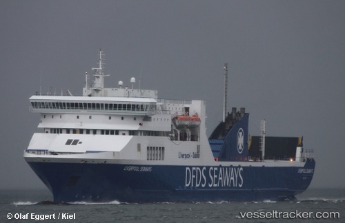
Vessel PELAGOS IMO: 9136034, MMSI: 212806000 Ro-Ro/Passenger Ship
UTC, 26.74545, 33.94915, course: 140, speed: 0
UTC, 26.74553, 33.94912, course: -1, speed: 0.1
2026-03-11 16:17:19 UTC, 26.74557, 33.94915, course: -1, speed: 0.1
Live Vessel PELAGOS Analytics (details, animations, etc.)
Live AIS position: UTC. Near SAFAGA), updated 2026-03-11 16:17:19 UTC.Find the position of the vessel PELAGOS on the map. The latter are known coordinates and path.
marine traffic ship tracker show on live map
The current position of vessel PELAGOS is 26.74557 lat / 33.94915 lng. Updated: 2026-03-11 16:17:19 UTCCurrently sailing under the flag of Cyprus
Details:
Last coordinates of the vessel:
UTC, 26.74545, 33.94916, course: 140, speed: 0UTC, 26.74545, 33.94915, course: 140, speed: 0
UTC, 26.74553, 33.94912, course: -1, speed: 0.1
2026-03-11 16:17:19 UTC, 26.74557, 33.94915, course: -1, speed: 0.1