 vesseltracker.com
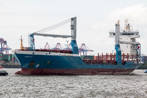
Vessel Queen B IMO: 9318929, MMSI: 212960000 Container Ship
UTC, 27.01500, -84.36666, course: -1, speed: 14
UTC, 26.82437, -84.78211, course: 246, speed: 13.8
2026-02-26 15:30:31 UTC, 26.61615, -85.28747, course: 242, speed: 14.5
Live AIS position:
UTC. 147 nm W of Anna Maria),
updated 2026-02-26 15:30:31 UTC.
Find the position of the vessel Queen B on the map. The latter are known coordinates and path.
marine traffic ship tracker show on live map
The current position of vessel Queen B is 26.61615 lat / -85.28747 lng. Updated: 2026-02-26 15:30:31 UTCCurrently sailing under the flag of Cyprus
Queen B built in 2004 year
Deadweight:
8223 tDetails:
Last coordinates of the vessel:
UTC, 27.21960, -83.88247, course: 245, speed: 13.9UTC, 27.01500, -84.36666, course: -1, speed: 14
UTC, 26.82437, -84.78211, course: 246, speed: 13.8
2026-02-26 15:30:31 UTC, 26.61615, -85.28747, course: 242, speed: 14.5