 vesseltracker.com
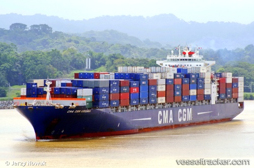
Vessel Cma Cgm Virginia IMO: 9351139, MMSI: 215165000 Container Ship
UTC, 47.5607, -122.507, course: 223, speed: 0.1
UTC, 47.56, -122.506, course: 250, speed: 0.2
2026-02-18 22:17:39 UTC, 47.561, -122.508, course: 204, speed: 0.2
Live AIS position:
UTC. Near Port Blakely),
updated 2026-02-18 22:17:39 UTC.
Find the position of the vessel Cma Cgm Virginia on the map. The latter are known coordinates and path.
marine traffic ship tracker show on live map
The current position of vessel Cma Cgm Virginia is 47.561 lat / -122.508 lng. Updated: 2026-02-18 22:17:39 UTCCurrently sailing under the flag of Malta
Cma Cgm Virginia built in 2008 year
Deadweight:
65890 tDetails:
Last coordinates of the vessel:
UTC, 47.561, -122.507, course: 214, speed: 0UTC, 47.5607, -122.507, course: 223, speed: 0.1
UTC, 47.56, -122.506, course: 250, speed: 0.2
2026-02-18 22:17:39 UTC, 47.561, -122.508, course: 204, speed: 0.2