 vesseltracker.com
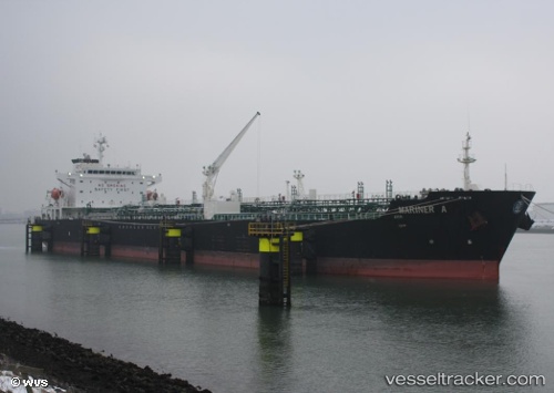
Vessel Mariner A IMO: 9288954, MMSI: 215817000 Chemical Oil Products Tanker
UTC, 40.1764, 26.3799, course: 175, speed: 12.9
UTC, 39.9757, 25.9365, course: 226, speed: 12.5
2026-02-04 03:45:37 UTC, 39.6339, 25.7222, course: 186, speed: 12.1
Live AIS position:
UTC. 19 nm NW of Baba Point),
updated 2026-02-04 03:45:37 UTC.
Find the position of the vessel Mariner A on the map. The latter are known coordinates and path.
marine traffic ship tracker show on live map
The current position of vessel Mariner A is 39.6339 lat / 25.7222 lng. Updated: 2026-02-04 03:45:37 UTCCurrently sailing under the flag of Malta
Mariner A built in 2005 year
Deadweight:
40099 tDetails:
Last coordinates of the vessel:
UTC, 40.4013, 26.6902, course: 233, speed: 11.7UTC, 40.1764, 26.3799, course: 175, speed: 12.9
UTC, 39.9757, 25.9365, course: 226, speed: 12.5
2026-02-04 03:45:37 UTC, 39.6339, 25.7222, course: 186, speed: 12.1