 vesseltracker.com
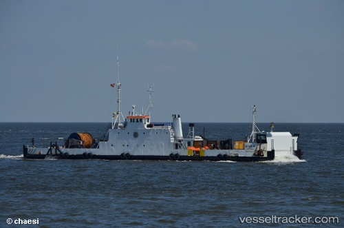
Vessel Mira A IMO: 9099171, MMSI: 219012076 Deck Cargo Ship
UTC, 56.01040, 11.06302, course: 204, speed: 3.6
UTC, 55.87403, 10.87967, course: 214, speed: 4.2
2026-02-10 15:23:37 UTC, 55.82262, 10.80697, course: 172, speed: 3.7
Live AIS position:
UTC. Near Ballen),
updated 2026-02-10 15:23:37 UTC.
Find the position of the vessel Mira A on the map. The latter are known coordinates and path.
marine traffic ship tracker show on live map
The current position of vessel Mira A is 55.82262 lat / 10.80697 lng. Updated: 2026-02-10 15:23:37 UTCCurrently sailing under the flag of Denmark
Mira A built in 1969 year
Deadweight:
200 tDetails:
Last coordinates of the vessel:
UTC, 56.10839, 11.19527, course: 235, speed: 3.4UTC, 56.01040, 11.06302, course: 204, speed: 3.6
UTC, 55.87403, 10.87967, course: 214, speed: 4.2
2026-02-10 15:23:37 UTC, 55.82262, 10.80697, course: 172, speed: 3.7