 vesseltracker.com
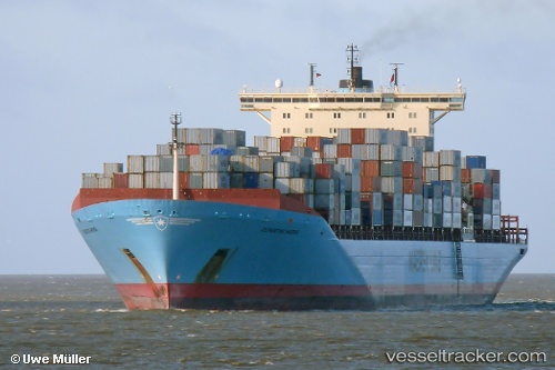
Vessel Clementine Maersk IMO: 9245770, MMSI: 220164000 Container Ship
UTC, -31.40686, 30.32473, course: -1, speed: 23.3
UTC, -31.99449, 29.67870, course: 230, speed: 23.3
2026-03-04 22:28:29 UTC, -31.99449, 29.67870, course: 230, speed: 23.3
Live Vessel Clementine Maersk Analytics (details, animations, etc.)
Live AIS position: UTC. 23 nm S of Port Saint John's), updated 2026-03-04 22:28:29 UTC.Find the position of the vessel Clementine Maersk on the map. The latter are known coordinates and path.
marine traffic ship tracker show on live map
The current position of vessel Clementine Maersk is -31.99449 lat / 29.67870 lng. Updated: 2026-03-04 22:28:29 UTCDetails:
Last coordinates of the vessel:
UTC, -31.40686, 30.32473, course: -1, speed: 23.3UTC, -31.40686, 30.32473, course: -1, speed: 23.3
UTC, -31.99449, 29.67870, course: 230, speed: 23.3
2026-03-04 22:28:29 UTC, -31.99449, 29.67870, course: 230, speed: 23.3