 vesseltracker.com
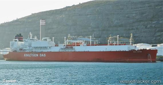
Vessel Rioja Knutsen IMO: 9721736, MMSI: 224451000 Lng Tanker
UTC, 26.25680, -78.64922, course: 102, speed: 17.3
UTC, 26.04500, -77.93500, course: -1, speed: 17
2026-01-29 20:03:21 UTC, 25.79487, -77.51622, course: 122, speed: 17.7
Live AIS position:
UTC. 17 nm S of Gorda Cay),
updated 2026-01-29 20:03:21 UTC.
Find the position of the vessel Rioja Knutsen on the map. The latter are known coordinates and path.
marine traffic ship tracker show on live map
The current position of vessel Rioja Knutsen is 25.79487 lat / -77.51622 lng. Updated: 2026-01-29 20:03:21 UTCDetails:
Last coordinates of the vessel:
UTC, 26.28980, -79.22595, course: 72, speed: 17.9UTC, 26.25680, -78.64922, course: 102, speed: 17.3
UTC, 26.04500, -77.93500, course: -1, speed: 17
2026-01-29 20:03:21 UTC, 25.79487, -77.51622, course: 122, speed: 17.7