 vesseltracker.com
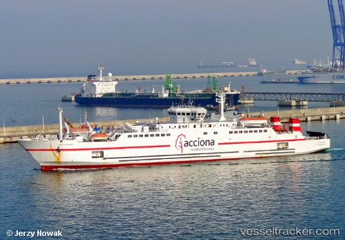
Vessel C.de Malaga IMO: 9080015, MMSI: 224549000 Passenger Ro Ro Cargo Ship
UTC, 36.13150, -5.43733, course: 52, speed: 0
UTC, 35.94083, -5.50050, course: 214, speed: 11.3
2026-01-30 13:48:16 UTC, 35.87833, -5.51750, course: 330, speed: 0
Live AIS position:
UTC. Near TANGER MED),
updated 2026-01-30 13:48:16 UTC.
Find the position of the vessel C.de Malaga on the map. The latter are known coordinates and path.
marine traffic ship tracker show on live map
The current position of vessel C.de Malaga is 35.87833 lat / -5.51750 lng. Updated: 2026-01-30 13:48:16 UTCCurrently sailing under the flag of Spain
C.de Malaga built in 1998 year
Deadweight:
2164 tDetails:
Last coordinates of the vessel:
UTC, 36.12767, -5.43683, course: 262, speed: 0.1UTC, 36.13150, -5.43733, course: 52, speed: 0
UTC, 35.94083, -5.50050, course: 214, speed: 11.3
2026-01-30 13:48:16 UTC, 35.87833, -5.51750, course: 330, speed: 0