 vesseltracker.com
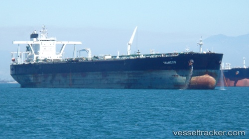
Vessel Yiangos IMO: 9414931, MMSI: 229059000 Crude Oil Tanker
UTC, -19.14976, 40.24258, course: 33, speed: 12.7
UTC, -18.78167, 40.50333, course: -1, speed: 12
2026-02-27 11:31:57 UTC, -18.51833, 40.69500, course: -1, speed: 12
Live AIS position:
UTC. 146 nm S of António Enes),
updated 2026-02-27 11:31:57 UTC.
Find the position of the vessel Yiangos on the map. The latter are known coordinates and path.
marine traffic ship tracker show on live map
The current position of vessel Yiangos is -18.51833 lat / 40.69500 lng. Updated: 2026-02-27 11:31:57 UTCDetails:
Last coordinates of the vessel:
UTC, -19.52500, 40.00500, course: -1, speed: 12UTC, -19.14976, 40.24258, course: 33, speed: 12.7
UTC, -18.78167, 40.50333, course: -1, speed: 12
2026-02-27 11:31:57 UTC, -18.51833, 40.69500, course: -1, speed: 12