 vesseltracker.com
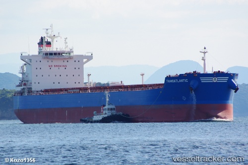
Vessel Transatlantic IMO: 9597238, MMSI: 229125000 Bulk Carrier
UTC, 53.74702, 168.93439, course: 80, speed: 6
UTC, 53.75820, 169.11017, course: 80, speed: 6.5
2026-02-28 07:31:58 UTC, 53.77681, 169.40729, course: 80, speed: 5.5
Live AIS position:
UTC. 147 nm SE of Nikolskoe),
updated 2026-02-28 07:31:58 UTC.
Find the position of the vessel Transatlantic on the map. The latter are known coordinates and path.
marine traffic ship tracker show on live map
The current position of vessel Transatlantic is 53.77681 lat / 169.40729 lng. Updated: 2026-02-28 07:31:58 UTCDetails:
Last coordinates of the vessel:
UTC, 53.72568, 168.43047, course: 91, speed: 5.7UTC, 53.74702, 168.93439, course: 80, speed: 6
UTC, 53.75820, 169.11017, course: 80, speed: 6.5
2026-02-28 07:31:58 UTC, 53.77681, 169.40729, course: 80, speed: 5.5