 vesseltracker.com
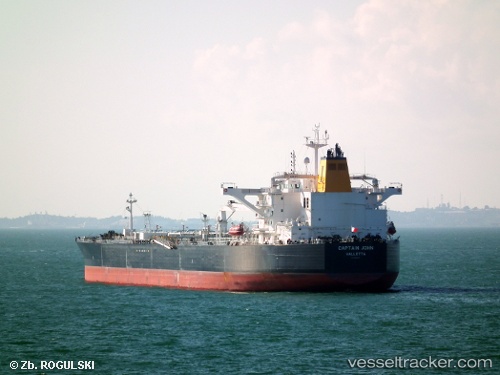
Vessel Captain John IMO: 9692832, MMSI: 229717000 Crude Oil Tanker
UTC, -6.79565, 46.38884, course: 275, speed: 12.4
UTC, -6.79189, 46.21049, course: 270, speed: 12.9
2026-02-14 17:25:16 UTC, -6.78866, 45.77742, course: 270, speed: 12.9
Live AIS position:
UTC. 332 nm N of Mutsamudu, Anjouan),
updated 2026-02-14 17:25:16 UTC.
Find the position of the vessel Captain John on the map. The latter are known coordinates and path.
marine traffic ship tracker show on live map
The current position of vessel Captain John is -6.78866 lat / 45.77742 lng. Updated: 2026-02-14 17:25:16 UTCCurrently sailing under the flag of Malta
Details:
Last coordinates of the vessel:
UTC, -6.79802, 46.93973, course: 271, speed: 12.4UTC, -6.79565, 46.38884, course: 275, speed: 12.4
UTC, -6.79189, 46.21049, course: 270, speed: 12.9
2026-02-14 17:25:16 UTC, -6.78866, 45.77742, course: 270, speed: 12.9