 vesseltracker.com
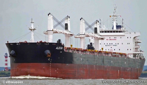
Vessel Alexia IMO: 9701372, MMSI: 229960000 Bulk Carrier
UTC, -40.79516, 16.49190, course: 81, speed: 11.5
UTC, -40.68494, 17.03073, course: 71, speed: 11.2
2026-02-16 22:30:57 UTC, -40.54866, 17.63252, course: 71, speed: 10.8
Live AIS position:
UTC. 207 nm SE of Caufield North),
updated 2026-02-16 22:30:57 UTC.
Find the position of the vessel Alexia on the map. The latter are known coordinates and path.
marine traffic ship tracker show on live map
The current position of vessel Alexia is -40.54866 lat / 17.63252 lng. Updated: 2026-02-16 22:30:57 UTCCurrently sailing under the flag of Malta
Details:
Last coordinates of the vessel:
UTC, -40.85855, 16.19969, course: 78, speed: 11.9UTC, -40.79516, 16.49190, course: 81, speed: 11.5
UTC, -40.68494, 17.03073, course: 71, speed: 11.2
2026-02-16 22:30:57 UTC, -40.54866, 17.63252, course: 71, speed: 10.8