 vesseltracker.com
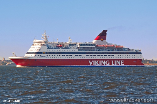
Vessel Gabriella IMO: 8917601, MMSI: 230361000 Passenger Ro Ro Cargo Ship
UTC, 60.43364, 22.22002, course: 287, speed: 0
UTC, 60.38211, 22.10479, course: 201, speed: 14.1
2026-01-25 07:54:28 UTC, 60.11210, 21.27930, course: 236, speed: 18.9
Live AIS position:
UTC. Near Träsk),
updated 2026-01-25 07:54:28 UTC.
Find the position of the vessel Gabriella on the map. The latter are known coordinates and path.
marine traffic ship tracker show on live map
The current position of vessel Gabriella is 60.11210 lat / 21.27930 lng. Updated: 2026-01-25 07:54:28 UTCCurrently sailing under the flag of Sweden
Gabriella built in 1992 year
Deadweight:
2962 tDetails:
Last coordinates of the vessel:
UTC, 60.42186, 22.16407, course: 92, speed: 8.6UTC, 60.43364, 22.22002, course: 287, speed: 0
UTC, 60.38211, 22.10479, course: 201, speed: 14.1
2026-01-25 07:54:28 UTC, 60.11210, 21.27930, course: 236, speed: 18.9