 vesseltracker.com
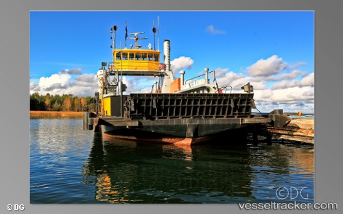
Vessel Nagu 2 IMO: 8634546, MMSI: 230938240 Passenger Ro Ro Cargo Ship
UTC, 62.94366, 21.17738, course: -1, speed: 0
UTC, 62.94365, 21.17738, course: -1, speed: 0
2026-03-01 15:43:04 UTC, 62.94366, 21.17739, course: -1, speed: 0
Live AIS position:
UTC. Near Petolahti),
updated 2026-03-01 15:43:04 UTC.
Find the position of the vessel Nagu 2 on the map. The latter are known coordinates and path.
marine traffic ship tracker show on live map
The current position of vessel Nagu 2 is 62.94366 lat / 21.17739 lng. Updated: 2026-03-01 15:43:04 UTCCurrently sailing under the flag of Finland
Nagu 2 built in 1960 year
Deadweight:
150 tDetails:
Last coordinates of the vessel:
UTC, 62.94366, 21.17738, course: -1, speed: 0UTC, 62.94366, 21.17738, course: -1, speed: 0
UTC, 62.94365, 21.17738, course: -1, speed: 0
2026-03-01 15:43:04 UTC, 62.94366, 21.17739, course: -1, speed: 0