 vesseltracker.com
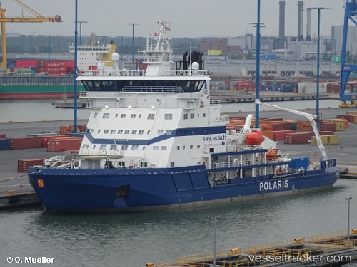
Vessel Polaris IMO: 6411421, MMSI: 230961000 Tug
UTC, 61.12680, 21.42319, course: 267, speed: 8.3
UTC, 61.12655, 21.44996, course: 72, speed: 0
2026-01-27 12:07:06 UTC, 61.12655, 21.44991, course: 72, speed: 0
Live AIS position:
UTC. Near Rauma),
updated 2026-01-27 12:07:06 UTC.
Find the position of the vessel Polaris on the map. The latter are known coordinates and path.
marine traffic ship tracker show on live map
The current position of vessel Polaris is 61.12655 lat / 21.44991 lng. Updated: 2026-01-27 12:07:06 UTCCurrently sailing under the flag of Finland
Polaris built in 1964 year
Details:
Last coordinates of the vessel:
UTC, 61.12653, 21.44994, course: 57, speed: 0.1UTC, 61.12680, 21.42319, course: 267, speed: 8.3
UTC, 61.12655, 21.44996, course: 72, speed: 0
2026-01-27 12:07:06 UTC, 61.12655, 21.44991, course: 72, speed: 0