 vesseltracker.com
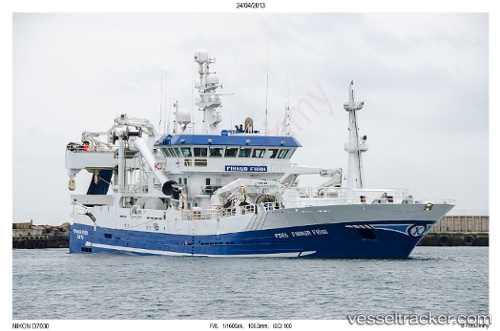
Vessel Finnur Fridi IMO: 9279238, MMSI: 231307000 Fish Carrier
UTC, 62.61322, -12.48053, course: 288, speed: 14.7
UTC, 62.80500, -13.92833, course: -1, speed: 12
2026-02-17 17:46:45 UTC, 62.88333, -14.53667, course: -1, speed: 12
Live AIS position:
UTC. 84 nm SW of Gardabaer),
updated 2026-02-17 17:46:45 UTC.
Find the position of the vessel Finnur Fridi on the map. The latter are known coordinates and path.
marine traffic ship tracker show on live map
The current position of vessel Finnur Fridi is 62.88333 lat / -14.53667 lng. Updated: 2026-02-17 17:46:45 UTCDetails:
Last coordinates of the vessel:
UTC, 62.49400, -11.53999, course: 284, speed: 14UTC, 62.61322, -12.48053, course: 288, speed: 14.7
UTC, 62.80500, -13.92833, course: -1, speed: 12
2026-02-17 17:46:45 UTC, 62.88333, -14.53667, course: -1, speed: 12