 vesseltracker.com
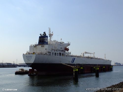
Vessel Hellespont Protector IMO: 9351452, MMSI: 232012083 Crude Oil Tanker
UTC, 30.76143, -44.93528, course: 80, speed: 12.4
UTC, 30.79942, -44.65537, course: 81, speed: 12.5
2026-02-20 01:54:34 UTC, 30.96778, -43.56538, course: 80, speed: 12.9
Live AIS position:
UTC. 132 nm S of Girard),
updated 2026-02-20 01:54:34 UTC.
Find the position of the vessel Hellespont Protector on the map. The latter are known coordinates and path.
marine traffic ship tracker show on live map
The current position of vessel Hellespont Protector is 30.96778 lat / -43.56538 lng. Updated: 2026-02-20 01:54:34 UTCCurrently sailing under the flag of United Kingdom
Hellespont Protector built in 2007 year
Deadweight:
73821 tDetails:
Last coordinates of the vessel:
UTC, 30.67778, -45.46390, course: 79, speed: 12UTC, 30.76143, -44.93528, course: 80, speed: 12.4
UTC, 30.79942, -44.65537, course: 81, speed: 12.5
2026-02-20 01:54:34 UTC, 30.96778, -43.56538, course: 80, speed: 12.9