 vesseltracker.com
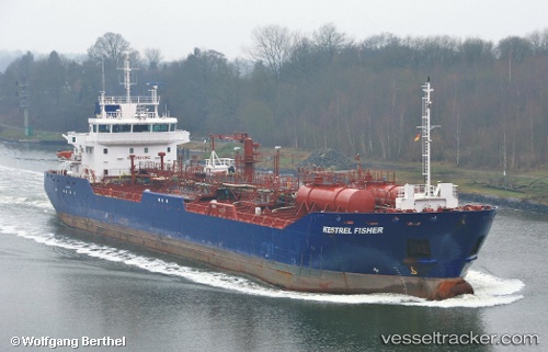
Vessel KESTREL FISHER IMO: 9556040, MMSI: 232059972 Oil Products Tanker
UTC, 6.77833, -58.17500, course: -1, speed: 0
UTC, 6.75667, -58.18500, course: -1, speed: 4
2026-02-26 17:55:40 UTC, 6.75147, -58.18786, course: 201, speed: 0
Live AIS position:
UTC. Near Diamond),
updated 2026-02-26 17:55:40 UTC.
Find the position of the vessel KESTREL FISHER on the map. The latter are known coordinates and path.
marine traffic ship tracker show on live map
The current position of vessel KESTREL FISHER is 6.75147 lat / -58.18786 lng. Updated: 2026-02-26 17:55:40 UTCCurrently sailing under the flag of United Kingdom
Details:
Last coordinates of the vessel:
UTC, 6.77993, -58.17523, course: 20, speed: 0UTC, 6.77833, -58.17500, course: -1, speed: 0
UTC, 6.75667, -58.18500, course: -1, speed: 4
2026-02-26 17:55:40 UTC, 6.75147, -58.18786, course: 201, speed: 0