 vesseltracker.com
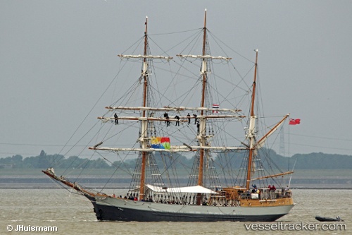
Vessel KASKELOT IMO: 5183120, MMSI: 235000132 Passenger Ship
UTC, 55.69230, -4.95901, course: 342, speed: 7.5
UTC, 55.69230, -4.95901, course: 342, speed: 7.5
2026-02-16 17:52:58 UTC, 55.69230, -4.95901, course: 342, speed: 7.5
Live AIS position:
UTC. Near Cumbraes),
updated 2026-02-16 17:52:58 UTC.
Find the position of the vessel KASKELOT on the map. The latter are known coordinates and path.
marine traffic ship tracker show on live map
The current position of vessel KASKELOT is 55.69230 lat / -4.95901 lng. Updated: 2026-02-16 17:52:58 UTCCurrently sailing under the flag of United Kingdom
KASKELOT built in 1948 year
Deadweight:
335 tDetails:
Last coordinates of the vessel:
UTC, 55.69230, -4.95901, course: 342, speed: 7.5UTC, 55.69230, -4.95901, course: 342, speed: 7.5
UTC, 55.69230, -4.95901, course: 342, speed: 7.5
2026-02-16 17:52:58 UTC, 55.69230, -4.95901, course: 342, speed: 7.5