 vesseltracker.com
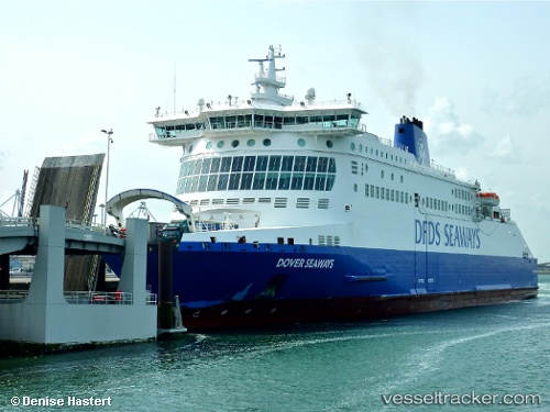
Vessel Dover Seaways IMO: 9318345, MMSI: 235010500 Passenger Ro Ro Cargo Ship
UTC, 51.04570, 2.00313, course: 272, speed: 16.8
UTC, 51.10489, 1.48397, course: 275, speed: 16.6
2026-02-26 10:00:07 UTC, 51.04939, 1.73914, course: 98, speed: 18.4
Live AIS position:
UTC. Near Calais),
updated 2026-02-26 10:00:07 UTC.
Find the position of the vessel Dover Seaways on the map. The latter are known coordinates and path.
marine traffic ship tracker show on live map
The current position of vessel Dover Seaways is 51.04939 lat / 1.73914 lng. Updated: 2026-02-26 10:00:07 UTCCurrently sailing under the flag of United Kingdom
Dover Seaways built in 2006 year
Deadweight:
6874 tDetails:
Last coordinates of the vessel:
UTC, 51.02111, 2.18852, course: 68, speed: 0UTC, 51.04570, 2.00313, course: 272, speed: 16.8
UTC, 51.10489, 1.48397, course: 275, speed: 16.6
2026-02-26 10:00:07 UTC, 51.04939, 1.73914, course: 98, speed: 18.4