 vesseltracker.com
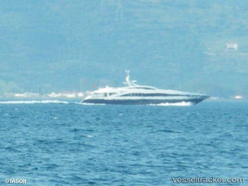
Vessel G Force IMO: 9400746, MMSI: 235011330 Service Ship
UTC, 41.10812, 1.23813, course: 113, speed: 0.1
UTC, 41.10809, 1.23812, course: 113, speed: 0.1
2026-02-18 18:16:57 UTC, 41.10806, 1.23808, course: 113, speed: 0.1
Live AIS position:
UTC. Near Tarragona),
updated 2026-02-18 18:16:57 UTC.
Find the position of the vessel G Force on the map. The latter are known coordinates and path.
marine traffic ship tracker show on live map
The current position of vessel G Force is 41.10806 lat / 1.23808 lng. Updated: 2026-02-18 18:16:57 UTCCurrently sailing under the flag of United Kingdom
G Force built in 2006 year
Deadweight:
144 tDetails:
Last coordinates of the vessel:
UTC, 41.10810, 1.23809, course: 113, speed: 0.1UTC, 41.10812, 1.23813, course: 113, speed: 0.1
UTC, 41.10809, 1.23812, course: 113, speed: 0.1
2026-02-18 18:16:57 UTC, 41.10806, 1.23808, course: 113, speed: 0.1