 vesseltracker.com
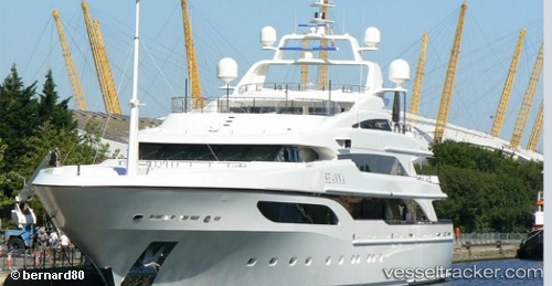
Vessel Seanna IMO: 1011501, MMSI: 235088016 Service Ship
UTC, 43.78870, 7.59859, course: 221, speed: 0
UTC, 43.78870, 7.59859, course: 221, speed: 0
2026-01-31 11:32:21 UTC, 43.78871, 7.59858, course: 221, speed: 0
Live AIS position:
UTC. Near CALA DEL FORTE),
updated 2026-01-31 11:32:21 UTC.
Find the position of the vessel Seanna on the map. The latter are known coordinates and path.
marine traffic ship tracker show on live map
The current position of vessel Seanna is 43.78871 lat / 7.59858 lng. Updated: 2026-01-31 11:32:21 UTCCurrently sailing under the flag of United Kingdom
Details:
Last coordinates of the vessel:
UTC, 43.78871, 7.59859, course: 221, speed: 0UTC, 43.78870, 7.59859, course: 221, speed: 0
UTC, 43.78870, 7.59859, course: 221, speed: 0
2026-01-31 11:32:21 UTC, 43.78871, 7.59858, course: 221, speed: 0