 vesseltracker.com
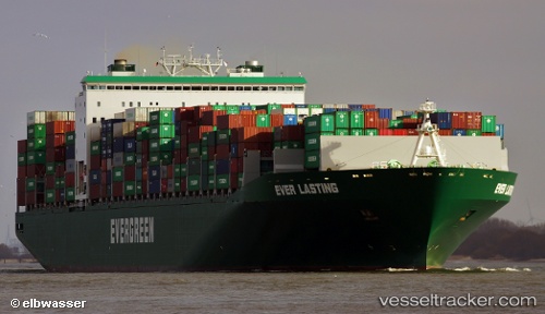
Vessel Ever Lasting IMO: 9595450, MMSI: 235093618 Container Ship
UTC, 33.51184, 123.25764, course: 161, speed: 13.2
UTC, 33.12337, 123.30012, course: 179, speed: 13.7
2026-02-13 07:58:50 UTC, 32.70318, 123.32882, course: 167, speed: 14
Live AIS position:
UTC. 95 nm NE of Lusi),
updated 2026-02-13 07:58:50 UTC.
Find the position of the vessel Ever Lasting on the map. The latter are known coordinates and path.
marine traffic ship tracker show on live map
The current position of vessel Ever Lasting is 32.70318 lat / 123.32882 lng. Updated: 2026-02-13 07:58:50 UTCDetails:
Last coordinates of the vessel:
UTC, 34.15640, 123.25625, course: 175, speed: 13.6UTC, 33.51184, 123.25764, course: 161, speed: 13.2
UTC, 33.12337, 123.30012, course: 179, speed: 13.7
2026-02-13 07:58:50 UTC, 32.70318, 123.32882, course: 167, speed: 14