 vesseltracker.com
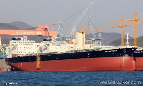
Vessel British Rigour IMO: 9683049, MMSI: 235108529 Crude Oil Tanker
UTC, 28.05053, -95.19779, course: 10, speed: 0
UTC, 28.05072, -95.19868, course: 22, speed: 0.2
2026-01-31 17:27:02 UTC, 28.05092, -95.19912, course: 31, speed: 0
Live AIS position:
UTC. 52 nm S of Quintana),
updated 2026-01-31 17:27:02 UTC.
Find the position of the vessel British Rigour on the map. The latter are known coordinates and path.
marine traffic ship tracker show on live map
The current position of vessel British Rigour is 28.05092 lat / -95.19912 lng. Updated: 2026-01-31 17:27:02 UTCDetails:
Last coordinates of the vessel:
UTC, 28.05053, -95.19779, course: 10, speed: 0UTC, 28.05053, -95.19779, course: 10, speed: 0
UTC, 28.05072, -95.19868, course: 22, speed: 0.2
2026-01-31 17:27:02 UTC, 28.05092, -95.19912, course: 31, speed: 0