 vesseltracker.com
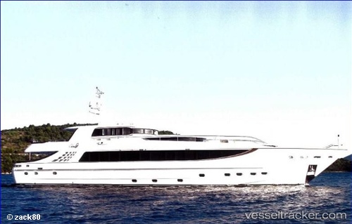
Vessel Cloud 9 IMO: 9457098, MMSI: 236435000 Service Ship
UTC, 24.98841, 55.02545, course: -1, speed: 0
UTC, 24.99358, 55.01994, course: -1, speed: 0.4
2026-01-30 13:43:09 UTC, 24.99371, 55.02004, course: -1, speed: 0.2
Live AIS position:
UTC. Near Jebel Ali Free Zone),
updated 2026-01-30 13:43:09 UTC.
Find the position of the vessel Cloud 9 on the map. The latter are known coordinates and path.
marine traffic ship tracker show on live map
The current position of vessel Cloud 9 is 24.99371 lat / 55.02004 lng. Updated: 2026-01-30 13:43:09 UTCDetails:
Last coordinates of the vessel:
UTC, 24.98838, 55.02553, course: -1, speed: 0UTC, 24.98841, 55.02545, course: -1, speed: 0
UTC, 24.99358, 55.01994, course: -1, speed: 0.4
2026-01-30 13:43:09 UTC, 24.99371, 55.02004, course: -1, speed: 0.2