 vesseltracker.com
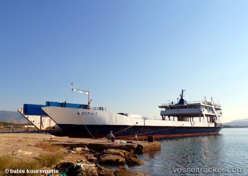
Vessel Maria T IMO: 7941411, MMSI: 237128700 Passenger Ro Ro Cargo Ship
UTC, 38.03607, 23.55194, course: -1, speed: 0
UTC, 38.03607, 23.55194, course: -1, speed: 0
2026-02-01 19:44:05 UTC, 38.03607, 23.55194, course: -1, speed: 0
Live AIS position:
UTC. Near Eleusina),
updated 2026-02-01 19:44:05 UTC.
Find the position of the vessel Maria T on the map. The latter are known coordinates and path.
marine traffic ship tracker show on live map
The current position of vessel Maria T is 38.03607 lat / 23.55194 lng. Updated: 2026-02-01 19:44:05 UTCCurrently sailing under the flag of Greece
Maria T built in 1979 year
Deadweight:
446 tDetails:
Last coordinates of the vessel:
UTC, 38.03607, 23.55197, course: -1, speed: 0UTC, 38.03607, 23.55194, course: -1, speed: 0
UTC, 38.03607, 23.55194, course: -1, speed: 0
2026-02-01 19:44:05 UTC, 38.03607, 23.55194, course: -1, speed: 0