 vesseltracker.com
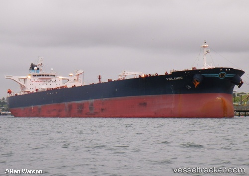
Vessel Violando IMO: 9429285, MMSI: 240955000 Crude Oil Tanker
UTC, 38.81760, 26.87845, course: 210, speed: 0
UTC, 38.81722, 26.87901, course: 219, speed: 0
2026-02-18 21:55:35 UTC, 38.81733, 26.87861, course: 208, speed: 0.1
Live AIS position:
UTC. Near Nemrut Bay),
updated 2026-02-18 21:55:35 UTC.
Find the position of the vessel Violando on the map. The latter are known coordinates and path.
marine traffic ship tracker show on live map
The current position of vessel Violando is 38.81733 lat / 26.87861 lng. Updated: 2026-02-18 21:55:35 UTCDetails:
Last coordinates of the vessel:
UTC, 38.81724, 26.87907, course: 220, speed: 0UTC, 38.81760, 26.87845, course: 210, speed: 0
UTC, 38.81722, 26.87901, course: 219, speed: 0
2026-02-18 21:55:35 UTC, 38.81733, 26.87861, course: 208, speed: 0.1