 vesseltracker.com
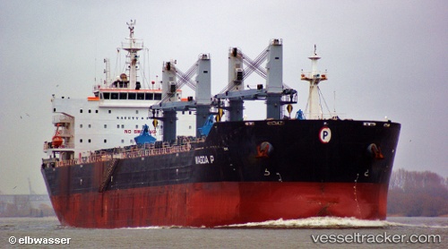
Vessel Magda P IMO: 9476692, MMSI: 241075000 Bulk Carrier
UTC, 35.71322, -4.84544, course: -1, speed: 2.2
UTC, 35.76500, -4.83167, course: -1, speed: 3
2026-02-26 10:09:38 UTC, 35.63258, -4.81482, course: 173, speed: 4.2
Live AIS position:
UTC. 22 nm E of Martil),
updated 2026-02-26 10:09:38 UTC.
Find the position of the vessel Magda P on the map. The latter are known coordinates and path.
marine traffic ship tracker show on live map
The current position of vessel Magda P is 35.63258 lat / -4.81482 lng. Updated: 2026-02-26 10:09:38 UTCDetails:
Last coordinates of the vessel:
UTC, 35.65184, -4.83980, course: -1, speed: 2UTC, 35.71322, -4.84544, course: -1, speed: 2.2
UTC, 35.76500, -4.83167, course: -1, speed: 3
2026-02-26 10:09:38 UTC, 35.63258, -4.81482, course: 173, speed: 4.2