 vesseltracker.com
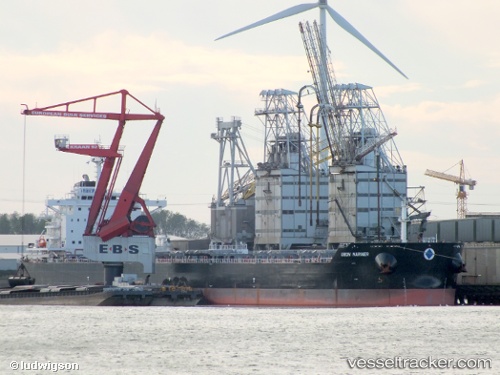
Vessel Union Mariner IMO: 9628934, MMSI: 241222000
UTC, -34.71533, 135.86969, course: 4, speed: 0
UTC, -34.71534, 135.86974, course: 4, speed: 0
2026-01-30 11:32:51 UTC, -34.71534, 135.86978, course: 4, speed: 0
Live AIS position:
UTC. Near Port Lincoln),
updated 2026-01-30 11:32:51 UTC.
Find the position of the vessel Union Mariner on the map. The latter are known coordinates and path.
marine traffic ship tracker show on live map
The current position of vessel Union Mariner is -34.71534 lat / 135.86978 lng. Updated: 2026-01-30 11:32:51 UTCCurrently sailing under the flag of Greece
Union Mariner built in 2013 year
Deadweight:
81964 tDetails:
Last coordinates of the vessel:
UTC, -34.71534, 135.86974, course: 4, speed: 0UTC, -34.71533, 135.86969, course: 4, speed: 0
UTC, -34.71534, 135.86974, course: 4, speed: 0
2026-01-30 11:32:51 UTC, -34.71534, 135.86978, course: 4, speed: 0