 vesseltracker.com
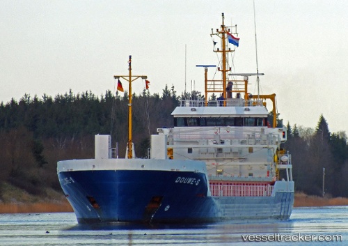
Vessel Douwe s IMO: 9467225, MMSI: 244956000 General Cargo Ship
UTC, 51.81851, 4.69989, course: 273, speed: 0
UTC, 51.81850, 4.69999, course: 273, speed: 0
2026-02-10 00:27:55 UTC, 51.81833, 4.69833, course: -1, speed: 0
Live AIS position:
UTC. Near PAPENDRECHT),
updated 2026-02-10 00:27:55 UTC.
Find the position of the vessel Douwe s on the map. The latter are known coordinates and path.
marine traffic ship tracker show on live map
The current position of vessel Douwe s is 51.81833 lat / 4.69833 lng. Updated: 2026-02-10 00:27:55 UTCCurrently sailing under the flag of Netherlands
Douwe s built in 2011 year
Deadweight:
3637 tDetails:
Last coordinates of the vessel:
UTC, 51.81833, 4.69833, course: -1, speed: 0UTC, 51.81851, 4.69989, course: 273, speed: 0
UTC, 51.81850, 4.69999, course: 273, speed: 0
2026-02-10 00:27:55 UTC, 51.81833, 4.69833, course: -1, speed: 0