 vesseltracker.com
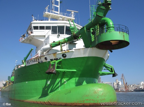
Vessel Reynaert IMO: 9360726, MMSI: 245043000 Hopper Dredger
UTC, 54.62729, 11.35780, course: 124, speed: 0
UTC, 54.62719, 11.35764, course: 117, speed: 0
2026-02-25 19:38:59 UTC, 54.62724, 11.35770, course: 121, speed: 0
Live AIS position:
UTC. Near Rødbyhavn),
updated 2026-02-25 19:38:59 UTC.
Find the position of the vessel Reynaert on the map. The latter are known coordinates and path.
marine traffic ship tracker show on live map
The current position of vessel Reynaert is 54.62724 lat / 11.35770 lng. Updated: 2026-02-25 19:38:59 UTCCurrently sailing under the flag of Netherlands
Reynaert built in 2007 year
Deadweight:
8327 tDetails:
Last coordinates of the vessel:
UTC, 54.62729, 11.35787, course: 149, speed: 0.1UTC, 54.62729, 11.35780, course: 124, speed: 0
UTC, 54.62719, 11.35764, course: 117, speed: 0
2026-02-25 19:38:59 UTC, 54.62724, 11.35770, course: 121, speed: 0