 vesseltracker.com
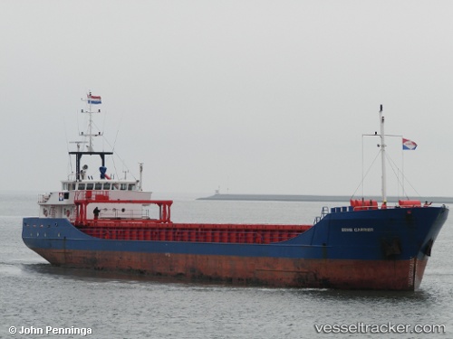
Vessel Eems Carrier IMO: 9148142, MMSI: 245257000 General Cargo Ship
UTC, 53.88967, 10.77628, course: 285, speed: 0
UTC, 53.89488, 10.79079, course: 94, speed: 4
2026-02-06 23:22:08 UTC, 54.02681, 10.96544, course: 67, speed: 0.3
Live AIS position:
UTC. Near Travemunde),
updated 2026-02-06 23:22:08 UTC.
Find the position of the vessel Eems Carrier on the map. The latter are known coordinates and path.
marine traffic ship tracker show on live map
The current position of vessel Eems Carrier is 54.02681 lat / 10.96544 lng. Updated: 2026-02-06 23:22:08 UTCCurrently sailing under the flag of Netherlands
Eems Carrier built in 1996 year
Deadweight:
2200 tDetails:
Last coordinates of the vessel:
UTC, 53.88966, 10.77624, course: 285, speed: 0UTC, 53.88967, 10.77628, course: 285, speed: 0
UTC, 53.89488, 10.79079, course: 94, speed: 4
2026-02-06 23:22:08 UTC, 54.02681, 10.96544, course: 67, speed: 0.3