 vesseltracker.com
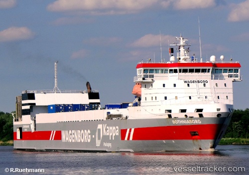
Vessel Bothniaborg IMO: 9267728, MMSI: 245656000 Ro Ro Cargo Ship
UTC, 65.23793, 21.62270, course: 327, speed: 0
UTC, 65.23793, 21.62268, course: 327, speed: 0
2026-01-28 12:14:25 UTC, 65.23795, 21.62267, course: 327, speed: 0
Live AIS position:
UTC. Near HARAHOLMEN),
updated 2026-01-28 12:14:25 UTC.
Find the position of the vessel Bothniaborg on the map. The latter are known coordinates and path.
marine traffic ship tracker show on live map
The current position of vessel Bothniaborg is 65.23795 lat / 21.62267 lng. Updated: 2026-01-28 12:14:25 UTCCurrently sailing under the flag of Netherlands
Bothniaborg built in 2004 year
Deadweight:
8600 tDetails:
Last coordinates of the vessel:
UTC, 65.23793, 21.62270, course: 327, speed: 0UTC, 65.23793, 21.62270, course: 327, speed: 0
UTC, 65.23793, 21.62268, course: 327, speed: 0
2026-01-28 12:14:25 UTC, 65.23795, 21.62267, course: 327, speed: 0