 vesseltracker.com
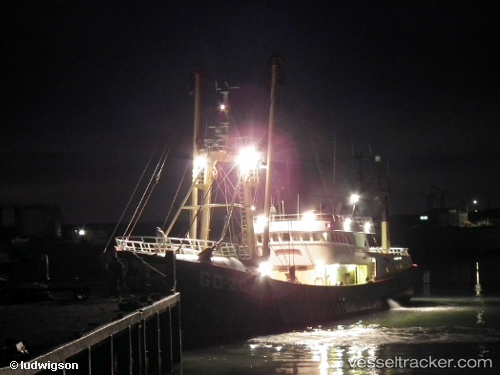
Vessel Go 20 Maria IMO: 8811182, MMSI: 245665000 Fishing Vessel
UTC, 51.80339, 4.64338, course: -1, speed: 0
UTC, 51.80339, 4.64335, course: -1, speed: 0
2026-03-17 03:52:38 UTC, 51.80340, 4.64338, course: -1, speed: 0
Live Vessel Go 20 Maria Analytics (details, animations, etc.)
Live AIS position: UTC. Near Dordrecht), updated 2026-03-17 03:52:38 UTC.Find the position of the vessel Go 20 Maria on the map. The latter are known coordinates and path.
marine traffic ship tracker show on live map
The current position of vessel Go 20 Maria is 51.80340 lat / 4.64338 lng. Updated: 2026-03-17 03:52:38 UTCCurrently sailing under the flag of Netherlands
Go 20 Maria built in 1988 year
Details:
Last coordinates of the vessel:
UTC, 51.80338, 4.64343, course: -1, speed: 0UTC, 51.80339, 4.64338, course: -1, speed: 0
UTC, 51.80339, 4.64335, course: -1, speed: 0
2026-03-17 03:52:38 UTC, 51.80340, 4.64338, course: -1, speed: 0