 vesseltracker.com
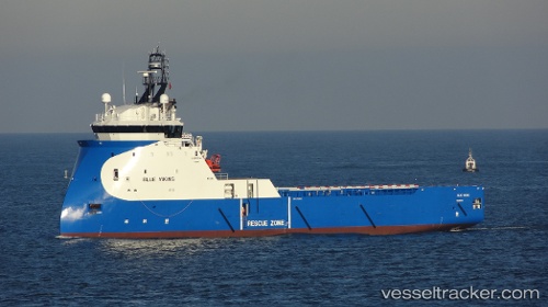
Vessel KOENIGSBORG IMO: 9722522, MMSI: 246071000 Offshore Supply Ship
UTC, 52.59129, 1.72740, course: 329, speed: 0
UTC, 52.59130, 1.72738, course: 329, speed: 0
2026-02-04 23:49:50 UTC, 52.59128, 1.72741, course: 329, speed: 0
Live AIS position:
UTC. Near GREAT YARMOUTH),
updated 2026-02-04 23:49:50 UTC.
Find the position of the vessel KOENIGSBORG on the map. The latter are known coordinates and path.
marine traffic ship tracker show on live map
The current position of vessel KOENIGSBORG is 52.59128 lat / 1.72741 lng. Updated: 2026-02-04 23:49:50 UTCCurrently sailing under the flag of Netherlands
KOENIGSBORG built in 2015 year
Deadweight:
4065 tDetails:
Last coordinates of the vessel:
UTC, 52.59129, 1.72736, course: 329, speed: 0UTC, 52.59129, 1.72740, course: 329, speed: 0
UTC, 52.59130, 1.72738, course: 329, speed: 0
2026-02-04 23:49:50 UTC, 52.59128, 1.72741, course: 329, speed: 0