 vesseltracker.com
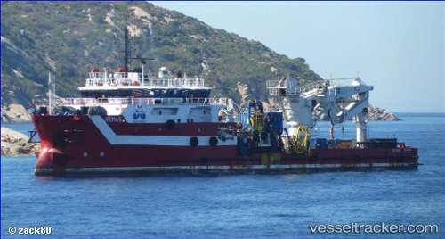
Vessel Remas IMO: 9586459, MMSI: 247321900 Offshore Tug Supply Ship
UTC, -4.77140, 11.83826, course: 35, speed: 0
UTC, -4.77120, 11.83825, course: 87, speed: 0
2026-02-01 05:54:27 UTC, -4.77112, 11.83825, course: 102, speed: 0
Live AIS position:
UTC. Near Pointe Noire),
updated 2026-02-01 05:54:27 UTC.
Find the position of the vessel Remas on the map. The latter are known coordinates and path.
marine traffic ship tracker show on live map
The current position of vessel Remas is -4.77112 lat / 11.83825 lng. Updated: 2026-02-01 05:54:27 UTCCurrently sailing under the flag of Italy
Remas built in 2011 year
Deadweight:
2681 tDetails:
Last coordinates of the vessel:
UTC, -4.77148, 11.83835, course: 7, speed: 0UTC, -4.77140, 11.83826, course: 35, speed: 0
UTC, -4.77120, 11.83825, course: 87, speed: 0
2026-02-01 05:54:27 UTC, -4.77112, 11.83825, course: 102, speed: 0