 vesseltracker.com
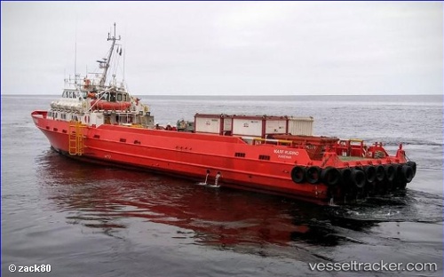
Vessel Mare Rubino IMO: 8964331, MMSI: 247340400 Offshore Tug Supply Ship
UTC, -4.78646, 11.83467, course: -1, speed: 0
UTC, -4.78650, 11.83452, course: 357, speed: 0
2026-01-26 07:25:28 UTC, -4.87700, 11.77737, course: 188, speed: 16.1
Live AIS position:
UTC. Near Pointe Noire),
updated 2026-01-26 07:25:28 UTC.
Find the position of the vessel Mare Rubino on the map. The latter are known coordinates and path.
marine traffic ship tracker show on live map
The current position of vessel Mare Rubino is -4.87700 lat / 11.77737 lng. Updated: 2026-01-26 07:25:28 UTCCurrently sailing under the flag of Italy
Details:
Last coordinates of the vessel:
UTC, -4.78649, 11.83460, course: -1, speed: 0UTC, -4.78646, 11.83467, course: -1, speed: 0
UTC, -4.78650, 11.83452, course: 357, speed: 0
2026-01-26 07:25:28 UTC, -4.87700, 11.77737, course: 188, speed: 16.1