 vesseltracker.com
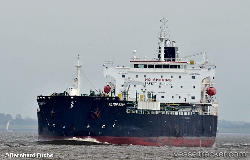
Vessel PS ROMA IMO: 9510462, MMSI: 247437400 Chemical/Oil Products Tanker
UTC, 17.95681, -119.38777, course: 284, speed: 12.2
UTC, 18.06560, -119.80609, course: 285, speed: 12.1
2026-02-08 09:52:07 UTC, 18.17310, -120.22740, course: 286, speed: 12
Live AIS position:
UTC. Open sea, approx. 473 nm off the nearest listed port),
updated 2026-02-08 09:52:07 UTC.
Find the position of the vessel PS ROMA on the map. The latter are known coordinates and path.
marine traffic ship tracker show on live map
The current position of vessel PS ROMA is 18.17310 lat / -120.22740 lng. Updated: 2026-02-08 09:52:07 UTCCurrently sailing under the flag of Italy
PS ROMA built in 2011 year
Deadweight:
51063 tDetails:
Last coordinates of the vessel:
UTC, 17.84806, -118.98250, course: 287, speed: 12.2UTC, 17.95681, -119.38777, course: 284, speed: 12.2
UTC, 18.06560, -119.80609, course: 285, speed: 12.1
2026-02-08 09:52:07 UTC, 18.17310, -120.22740, course: 286, speed: 12