 vesseltracker.com
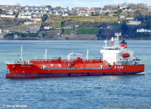
Vessel B Gas Maud IMO: 9363522, MMSI: 248102000 Lpg Tanker
UTC, 54.78012, 14.89588, course: 90, speed: 8.1
UTC, 54.77680, 15.54752, course: 90, speed: 8.9
2026-02-04 02:10:05 UTC, 54.77482, 15.98085, course: 87, speed: 9
Live AIS position:
UTC. 24 nm NW of DARLOWO),
updated 2026-02-04 02:10:05 UTC.
Find the position of the vessel B Gas Maud on the map. The latter are known coordinates and path.
marine traffic ship tracker show on live map
The current position of vessel B Gas Maud is 54.77482 lat / 15.98085 lng. Updated: 2026-02-04 02:10:05 UTCCurrently sailing under the flag of Malta
B Gas Maud built in 2006 year
Deadweight:
5073 tDetails:
Last coordinates of the vessel:
UTC, 54.81045, 14.51292, course: 116, speed: 8.6UTC, 54.78012, 14.89588, course: 90, speed: 8.1
UTC, 54.77680, 15.54752, course: 90, speed: 8.9
2026-02-04 02:10:05 UTC, 54.77482, 15.98085, course: 87, speed: 9