 vesseltracker.com
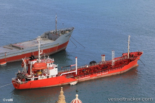
Vessel BLUESATION IMO: 9016454, MMSI: 248121000 Oil Products Tanker
UTC, 43.36806, -8.38561, course: -1, speed: 0
UTC, 43.36806, -8.38561, course: -1, speed: 0
2026-02-25 02:45:04 UTC, 43.36806, -8.38561, course: -1, speed: 0
Live AIS position:
UTC. Near La Coruña (A Coruña)),
updated 2026-02-25 02:45:04 UTC.
Find the position of the vessel BLUESATION on the map. The latter are known coordinates and path.
marine traffic ship tracker show on live map
The current position of vessel BLUESATION is 43.36806 lat / -8.38561 lng. Updated: 2026-02-25 02:45:04 UTCCurrently sailing under the flag of Malta
Details:
Last coordinates of the vessel:
UTC, 43.36808, -8.38561, course: -1, speed: 0UTC, 43.36806, -8.38561, course: -1, speed: 0
UTC, 43.36806, -8.38561, course: -1, speed: 0
2026-02-25 02:45:04 UTC, 43.36806, -8.38561, course: -1, speed: 0